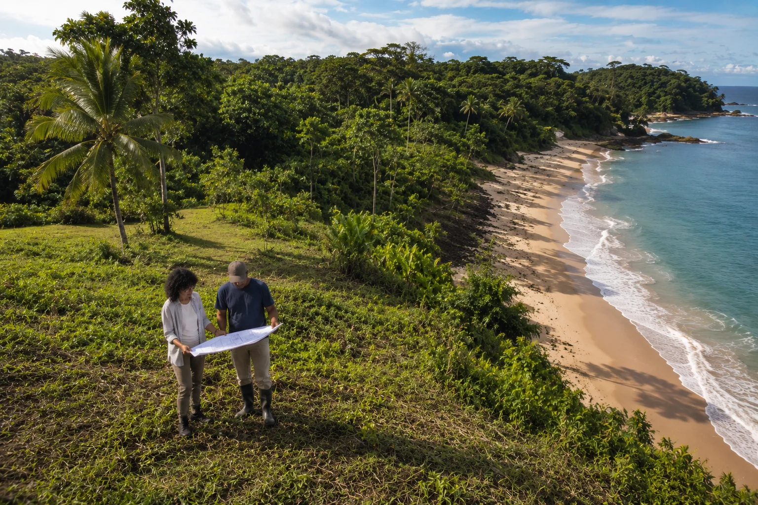
The first question we get when someone owns land facing the sea in Panama is rarely "what should the house look like?" It is almost always this: "Can I actually build here?"
And the honest answer is: it depends on four variables that are rarely evaluated before purchase.
We have worked with land on the Pacific coast, in Costa Arriba de Colón, in Bocas del Toro and in Chiriquí. In all those contexts, the first obstacle is rarely the design — it is the documentation. And the most expensive mistakes we see are not construction errors. They are diagnostic errors made before a single line was drawn.
This guide walks through the four variables anyone should verify before investing in a coastal project in Panama.
01 The coastal zone in Panama: the first legal framework
In Panama, a strip of 200 metres measured from the ordinary high tide line constitutes the maritime-terrestrial zone, regulated by coastal zone legislation. This strip is divided into two sub-zones with different legal regimes:
The first 20 metres from the high tide line are public zone: no private construction is permitted under any title. They are legally defined as public use, and any building within this strip can be subject to demolition orders.
The remaining 180 metres — from 20 to 200 metres — may be subject to maritime concession granted by ANATI, private title historically registered before current regulations, or in some cases, unregularised possession.
Knowing which sub-zone the land falls in is the starting point of any feasibility analysis. Land that is physically facing the sea is not necessarily buildable — and land with seemingly clean documentation may be in the public zone without the buyer knowing it.
02 The three types of tenure on coastal land
When we analyse coastal land for a client, the first thing we do is determine which of these three situations applies. Each has different implications for the permits required and the risk profile of the investment.
-
01
Private property title registered in the Public Registry. The most solid form of tenure. Some beachfront plots were titled before coastal zone regulations were enacted. With this title, the land is fully private property, but construction remains subject to MiAMBIENTE environmental permits and municipal building permits. The title does not eliminate restrictions — it only establishes the ownership basis.
-
02
Maritime concession issued by ANATI. The most common form of tenure in recently developed coastal areas. A concession grants the right to use land within the maritime-terrestrial zone for a set period, generally renewable. Concessions carry conditions of construction, use and maintenance. If these are not met, the concession can be revoked. Before buying land under a concession, it is essential to verify that it is current, has no unmet conditions, and is renewable.
-
03
Possession without title or without a valid concession. The riskiest situation — and unfortunately not uncommon. Plots are sold with unregistered "possession rights", with expired concessions or with concessions that were never formally processed. Building under these conditions leaves the investment completely unprotected, and obtaining construction permits on unregularised tenure is impossible.
"The title says the land is yours. MiAMBIENTE decides if you can use it. And ANATI sets the terms. All three have to align before it makes sense to talk about design."
03 MiAMBIENTE: the authority many people overlook
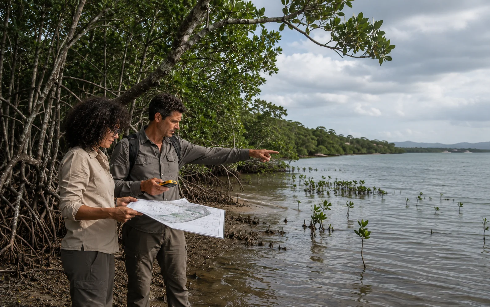
Even with title or concession in order, a beachfront plot in Panama can carry environmental restrictions that prevent construction or significantly limit what can be done. The Ministry of Environment (MiAMBIENTE) establishes buffer zones and protection areas around sensitive ecosystems:
Mangroves: buffer zone with no private construction. Mangroves are protected ecosystems under all Panamanian environmental legislation. Land that borders mangrove — or that was drained mangrove — carries restrictions that go beyond any private title.
Coral reefs: protection areas with restrictions on use and construction works. This particularly affects plots in the Panamanian Caribbean and in Bocas del Toro.
Protected areas and biological corridors: variable restrictions depending on the protection category. Some coastal biological corridors in Azuero and the central Pacific have buildability restrictions that do not appear in the Public Registry.
Estuaries and wetlands: subject to environmental impact assessment for any intervention. A plot in a Caribbean estuary surrounded by mangrove may have a clean title and be completely non-viable without exceptional environmental authorisation.
04 ANATI and the authorisation process for construction
The National Land Administration Authority (ANATI) manages the maritime-terrestrial zone in Panama. To build on concession land, or to obtain a new concession on unregularised plots, the process involves several steps prior to the municipal building permit:
First, verifying the concession status in ANATI's records — whether it is current, when it expires, and whether the originally approved development plan is compatible with the project to be built.
Second, obtaining ANATI's construction authorisation, which precedes the municipal permit application. This authorisation reviews that the project is consistent with the concession conditions and with coastal zone regulations.
The process can take between three and twelve months depending on the complexity of the case, the location, and whether MiAMBIENTE raises observations. Starting construction without this documentation in place is one of the most frequent — and most costly — mistakes we encounter in coastal projects in Panama.
05 The five questions that determine feasibility
Before talking about square metres, orientation or budget, these are the questions that need to be answered with documentation in hand:
-
01
Which coastal sub-zone is the land in?
Is it in the public zone (first 20 metres), within the concession zone (20–200 metres), or outside the regulated coastal zone? The answer is verified with ANATI's cadastre and by measuring from the high tide line — not from the seller's deed.
-
02
What is the type of tenure and is it in order?
Is it a private title registered in the Public Registry, a valid ANATI concession, or unregularised possession? If it is a concession, is it current, when does it expire, and what are its conditions? These answers cannot come from the seller alone — they must be verified directly in the official records.
-
03
Are there applicable MiAMBIENTE environmental restrictions?
Is there mangrove, coral reef, protected area or biological corridor on or adjacent to the land? Has there been intervention of protected ecosystems in the past? Direct consultation with MiAMBIENTE — or analysis with an architect experienced in coastal projects — is the only path to certainty.
-
04
Does the land have legal access, not just physical access?
Many coastal plots in Panama have physical access — reachable via the beach or a dirt track — but have no legally constituted right of way. Without documented legal access, the building permit can be blocked at the municipal review stage.
-
05
Does the cadastre reflect the actual situation of the land?
Discrepancies between the cadastral description and the physical reality of the plot are common in coastal areas, especially in recently developed zones. An up-to-date topographic survey, cross-referenced with the cadastral plan, is essential before designing any project.
06 Zone comparison: Pacific, Caribbean and archipelagos
The feasibility of coastal construction varies significantly by region. This table summarises general conditions in the zones where we have worked most frequently:
| Zone | Common tenure type | Construction possible | Main risk |
|---|---|---|---|
| Central Pacific (Chame, Las Lajas, Azuero) | Private title / ANATI concession | Yes, with permits | Public easement not respected |
| Caribbean — Costa Arriba (Colón) | Concession / Unregularised possession | Conditional | Mangrove and buffer zones |
| Chiriquí (Boca Chica, Barú) | Mixed — title and concession | Yes, with ATP and ANATI | Regulated tourism use zone |
| Bocas del Toro | Concession / Possession | Highly conditional | Protected areas and indigenous territories |
| Dry Arc (Tonosí, Mariato) | Consolidated private title | Yes, with permits | Legal access and biological corridor |
| General conditions — each case requires specific verification with ANATI and MiAMBIENTE records | |||
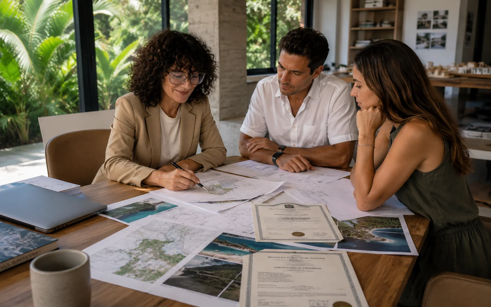
07 The feasibility assessment: what we evaluate before designing
Before any conversation about square metres, orientation or budget, at Biotopos the first step with any coastal land is a feasibility assessment. This process analyses the plot from four simultaneous angles:
Legal documentation: review of the title or concession in the Public Registry and in ANATI's records. Verification of validity, conditions of use and any encumbrances or limitations.
Environmental restrictions: consultation of MiAMBIENTE restrictions, identification of protected ecosystems in the surroundings, and assessment of whether an Environmental Impact Study will be required.
Field inspection: site visit to survey topography, access, orientation, visible soil conditions and relationship with the natural and built environment. Many times, what matters most cannot be seen on any plan — it is understood by being there.
Applicable regulations: review of municipal buildability regulations, required setbacks and specific coastal zone restrictions in that municipality.
The result is a working document that enables informed decisions: whether it makes sense to proceed with the project, what type of project is viable, what permits will be needed and how long they will take to obtain. In several cases, the preliminary assessment has allowed our clients to renegotiate the purchase conditions of a plot — or to rule out an acquisition before committing significant capital.
That first conversation about the land costs nothing. And in many cases, it is the one that ends up saving the most.
If you already have clarity on the legal and environmental variables and want to understand what kind of project makes sense to develop, the article Bioclimatic real estate projects in Panama explains the development model that best suits the conditions of the Panamanian Caribbean. And if you need to estimate costs before going further, How much does it cost to build a house in Panama? has real price ranges by project type.